
- 1.Foreword and accountability.
-
2: From the beginning till around 800AD.
- 2.1: It all starts with the history of Huisduinen.
- 2.2: What did the landscape look like around 800AD?
- 2.3: Landscape Den Helder around 800AD.
- 2.4: How was the peatland reclaimed?
- 2.5: Villages, trade and other means of subsistence around 800AD.
- 2.6: Live, houses and "villages" around 800AD.
- 2.7: Historical village names.
- 2.8: About Romans, Vikings, Danes and Norwegians.
- 3: Next.
Den Helder's history.
1.Foreword and accountability.
This history article started with the idea of just complementing the 1-page little story about Den Helder that was already present back in 2003 on my old website. But when digging up new information that was not available back then, I was so intrigued by what I found that I got more and more determined to put at least some of it into this story.This is the result, I hope you like it.
It is written in English, as was the old one, so people from other countries can read it too.
A lot of information for this article I got from "Husidina" , a book written by Drs J.T. Bremer, who was my geography teacher when I was young. Other info came from the Internet.
This history article is not complete, not much is written about some periods, so if you want to know more, maybe you should read the book, or follow the links in my article.
I have tried as much as possible to link to the place where I found certain information or illustrations. Let me know if I have missed things, or forgot to mention YOU as the rightful owner of something that I have used. I certainly don't pretend to have done the research, I just wanted to share what I found and make a readable story.
Don't forget to click on the pictures to get a better view. They open up in a separate window.
Have fun !!!
2. From the beginning till around 800AD.
2.1. It all starts with the history of Huisduinen.
Yes, you read that correctly, the name of Huisduinen was present and important, long before Den Helder was ever mentioned. The name Den Helder first pops up in the 16th century.The oldest records of Huisduinen ( or "Husidina" as it was then called), date way back to the year 885 AD. In that year, 885AD, Husidina was mentioned in a list of ecclesiastical property of the "St Maartens" church in Utrecht. That list is called "Cartularium Radbodi" and describes among other things, "3 mansi" (which are houses or homesteads) belonging to this church, but situated in Husidina, an area just below Texel, that was ruled at that time by the Vikings Rorik and Godfried (862-885). In those days, leased land was called "hosden", coming from "hosdinium", which is a leased farm.
Another well known name in our area "Marsdiep" was mentioned around 800AD, in the "Traditiones Fuldensis" when someone called "Gerwic from Fresia", donated land on the "fluvius Maresdeop" (which means: the river Marsdiep, or the sea Marsdiep) to the monastery of Fulda (in Germany).
Habitation of the beachwall nearby that "Maresdeop" is likely, although so far, no traces of that are found. Traces that have been found, date from Roman times before that. So it seems people must have lived there around that time.
To answer that question we have to look at the landscape as it was at that time.
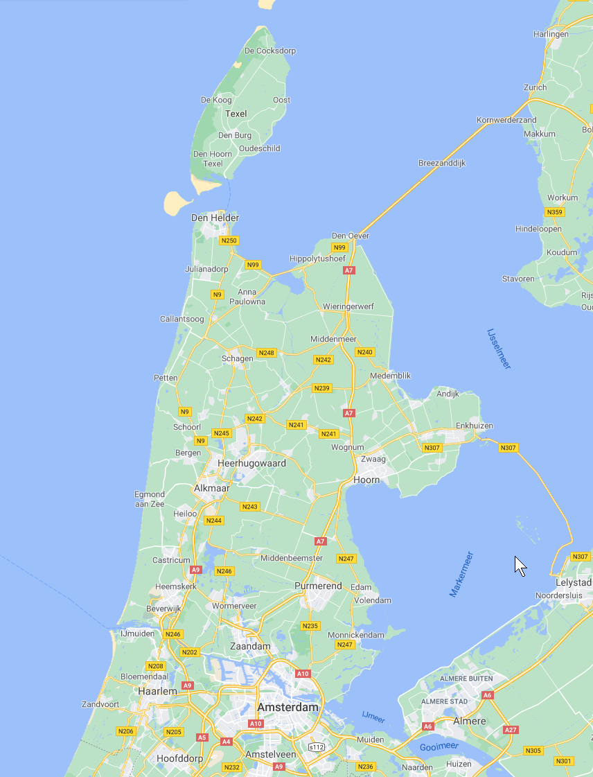
But first look at the map as it is today:
You can see the sharp contours of our province as well as those of the island of Texel.
The yellow line is the "afsluitdijk" (closure dike) between the provinces Noord-Holland and Friesland. In our minds we have that current map, with lots of cities and villages, roads, meadows, windmills, and so on, all protected from the sea by dikes and dunes.
Now compare this map with the map in the next chapter.
2.2. What did the landscape look like around 800AD?
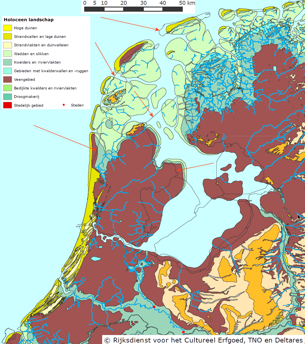
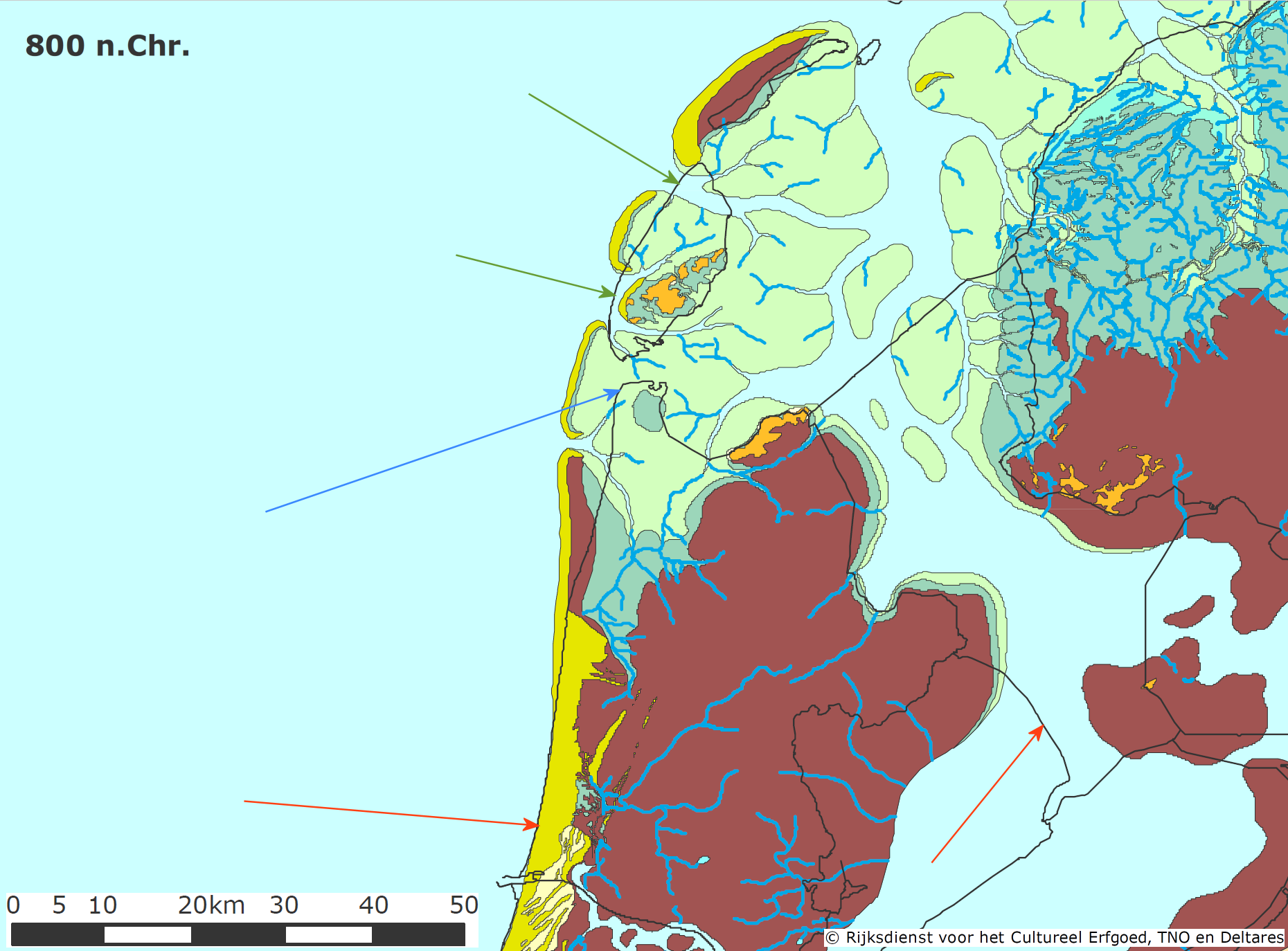
The dunes (in yellow) did not exist, at least not where they are now, but were laying about 8-10 kilometers more to the west. (to the left on the map)
Behind the yellow dunes was the wet peatland (the brownish area) It covered almost the entire province. The dark blue squiggly lines, in the greenish and brown area, are the tidal channels and streams , that bring the water back into the sea.
From the thin black lines on that map (click the map to zoom) you can see that around 800AD, the whole coastline was laying way more to the west then it is now. (the red arrows point to todays coastline)
The 2 tiny red dots near the bottom of the map, represent "cities" (there were not many in those days!).
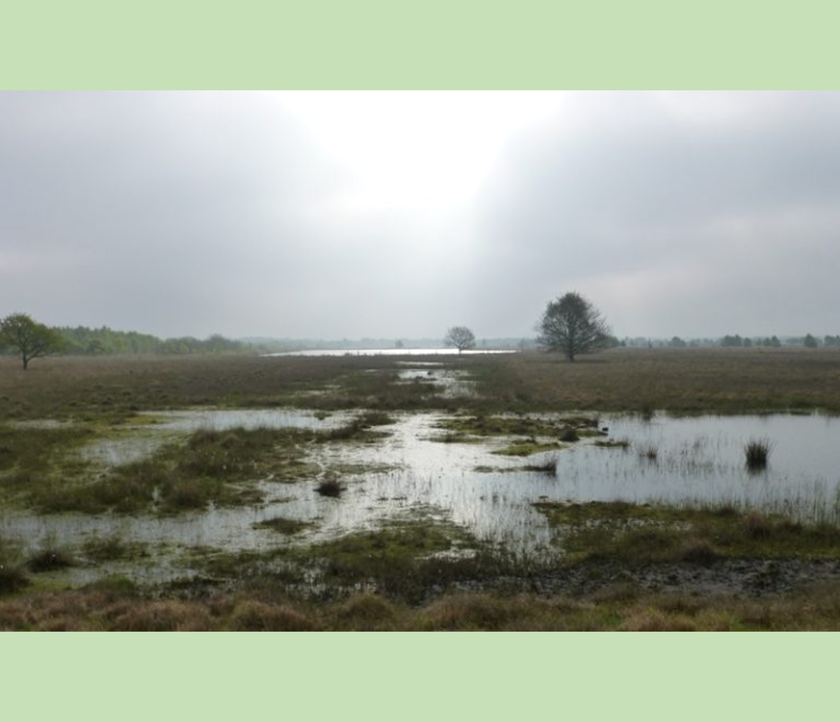
The landscape looked very different from today, very uninviting and rugged:
Yes, there were beaches with beach ridges and dunes along the sea, here and there overgrown with forests, but the ridges and dunes had tidal areas, large salt marshes , peatland, and wet and swampy peat bogs behind it, and all those together formed the "land".
And don't forget, the peatland had very acid soil (ph 3,5), which meant hardly any trees could grow there.
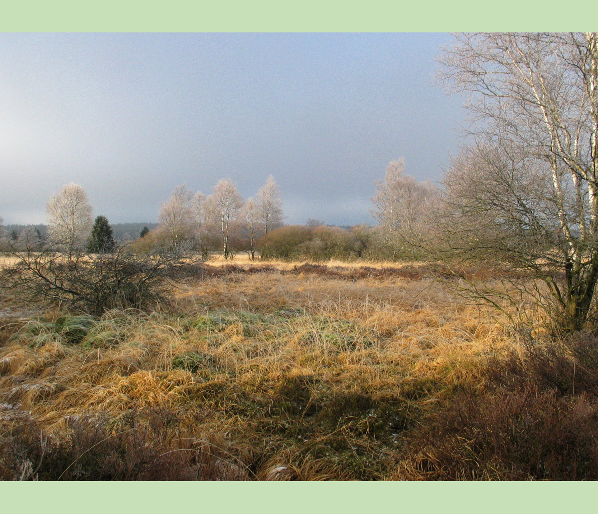
2.3. Landscape Den Helder around 800AD.
The next pictures try to give you an idea of how the landscape near Den Helder might have looked around 800AD.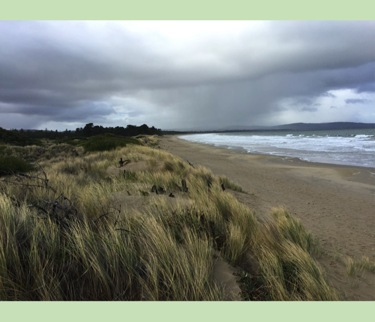
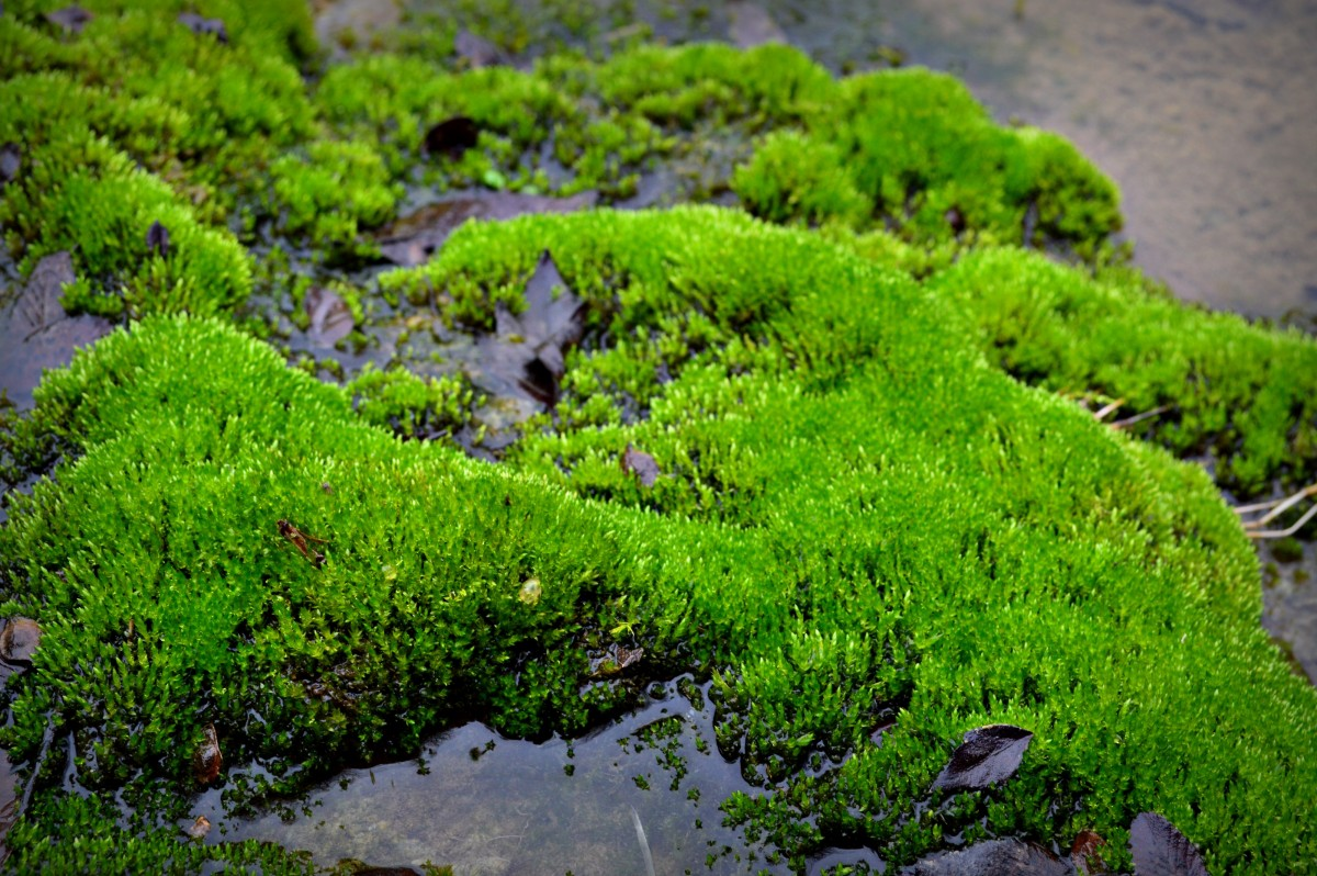
Beach Ridges
Seven mile beach ridge Tasmania by Thomas Oliver.
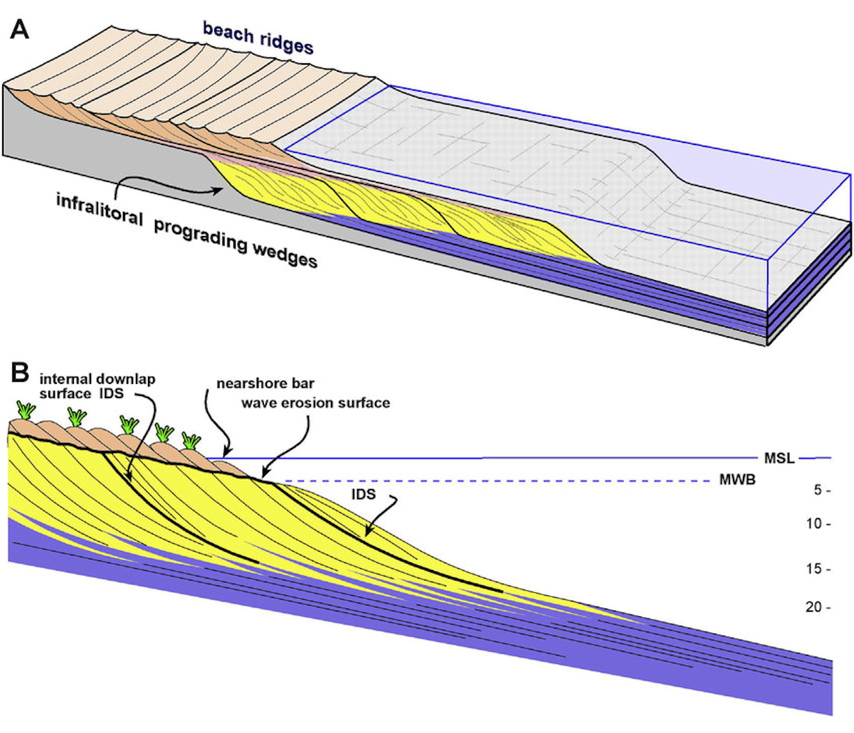
Beach Ridges
Beach Ridges, how they develop by wind and sea.
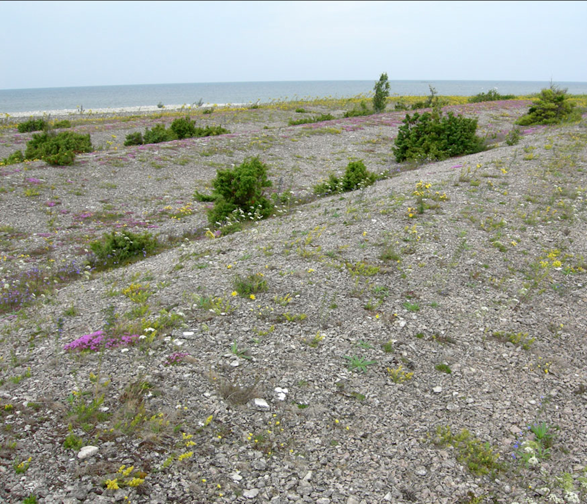
Beach Ridges
Beach Ridges - wikimedia.
Beach Ridges
Beach Ridges, developing states (Sciencedirect.com).

Beach Ridges
Beach Ridges early stage - wikimedia.
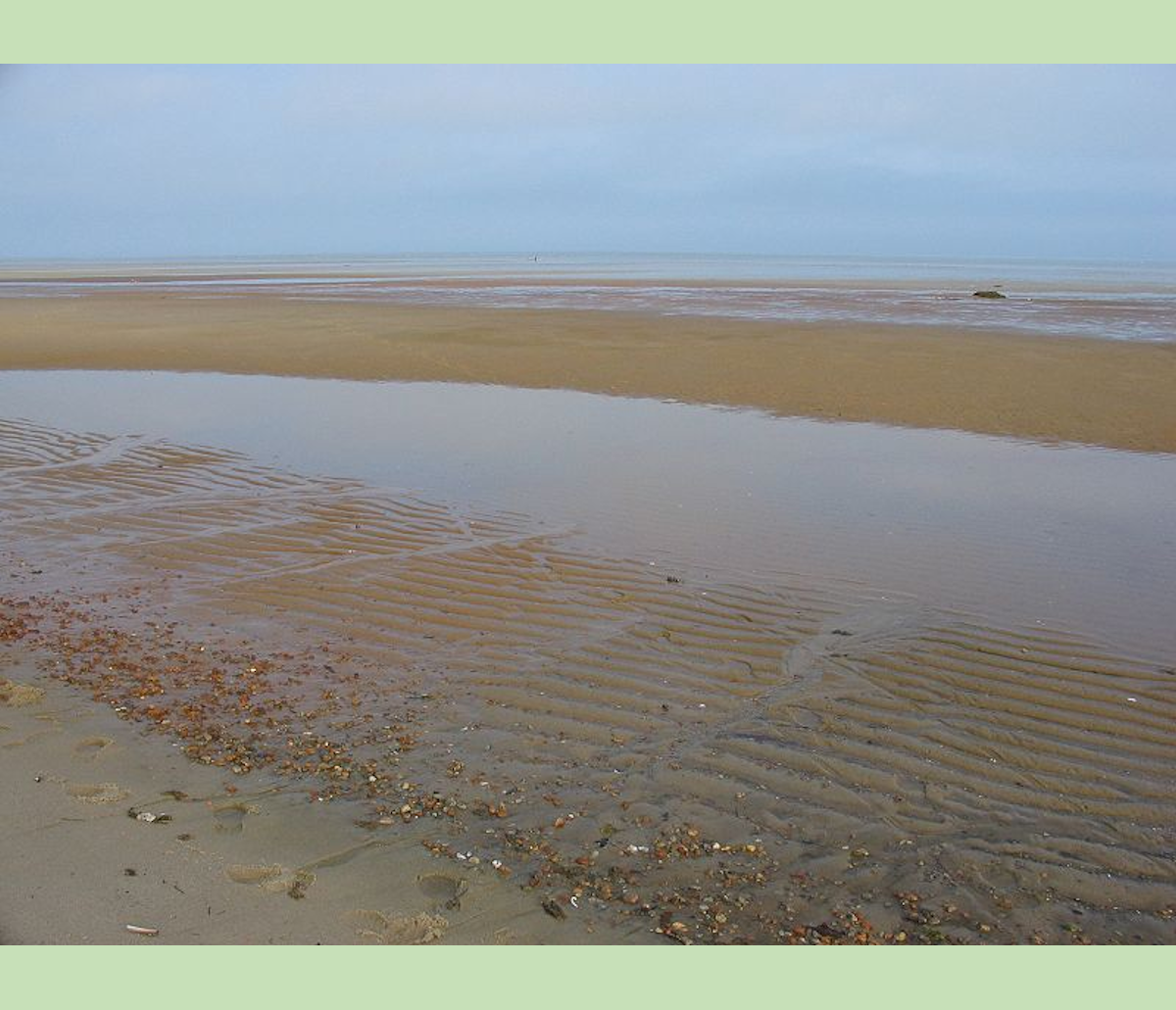
Mudflat
Brewster mudflat - wikimedia.
Mudflat
Hamford Water, Essex by Natural England / Peter Wakely / CC-BY.
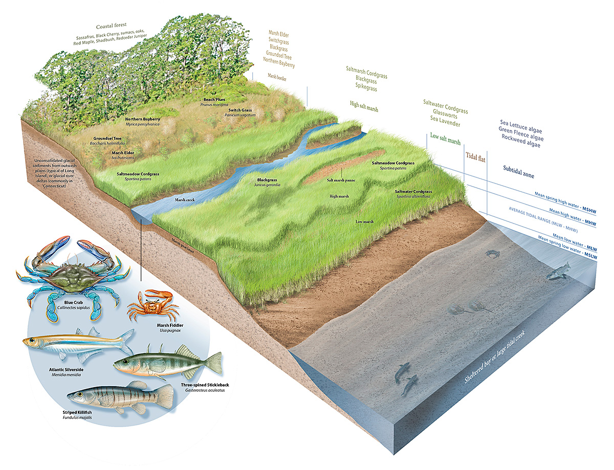
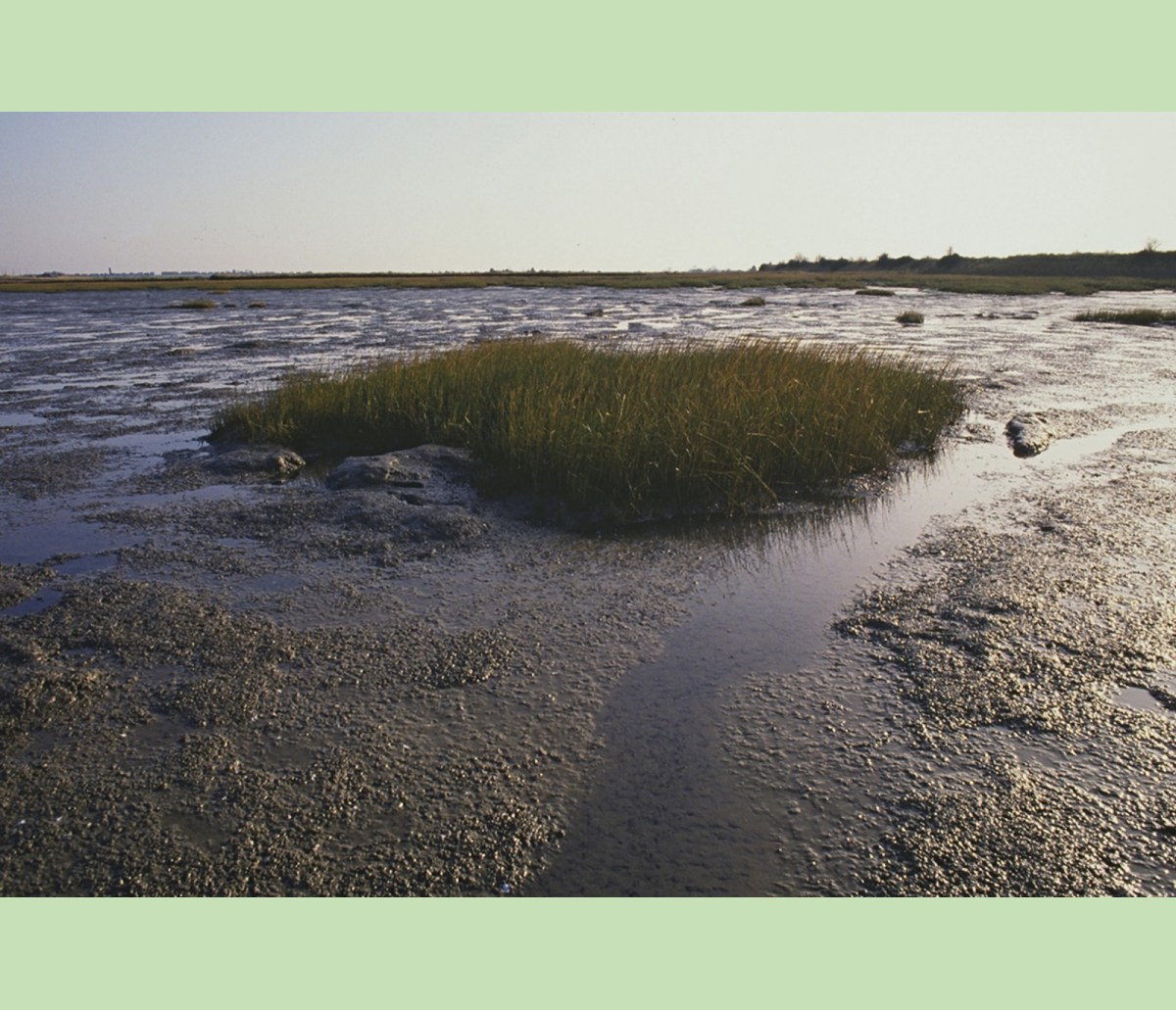
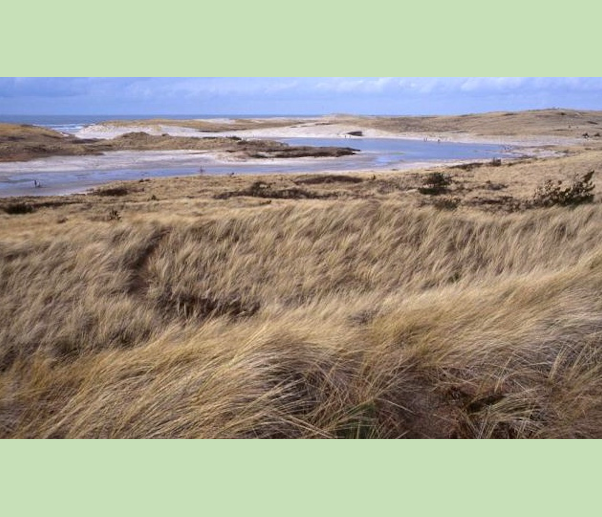
Salt Marshes
Salt Marshes - Waddenzee.

Salt Marshes
Salt Marshes - wikipedia.
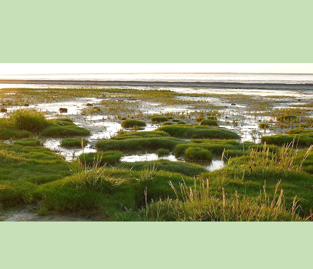
Salt Marshes
Salt Marshes, Ķemeri national park - naturetoday.com.
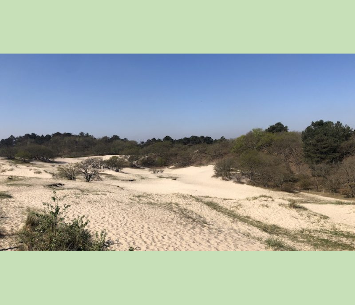
Dunes
Dunes near Bergen Noord-Holland.
Dunes
Dunes near Bergen Noord-Holland.
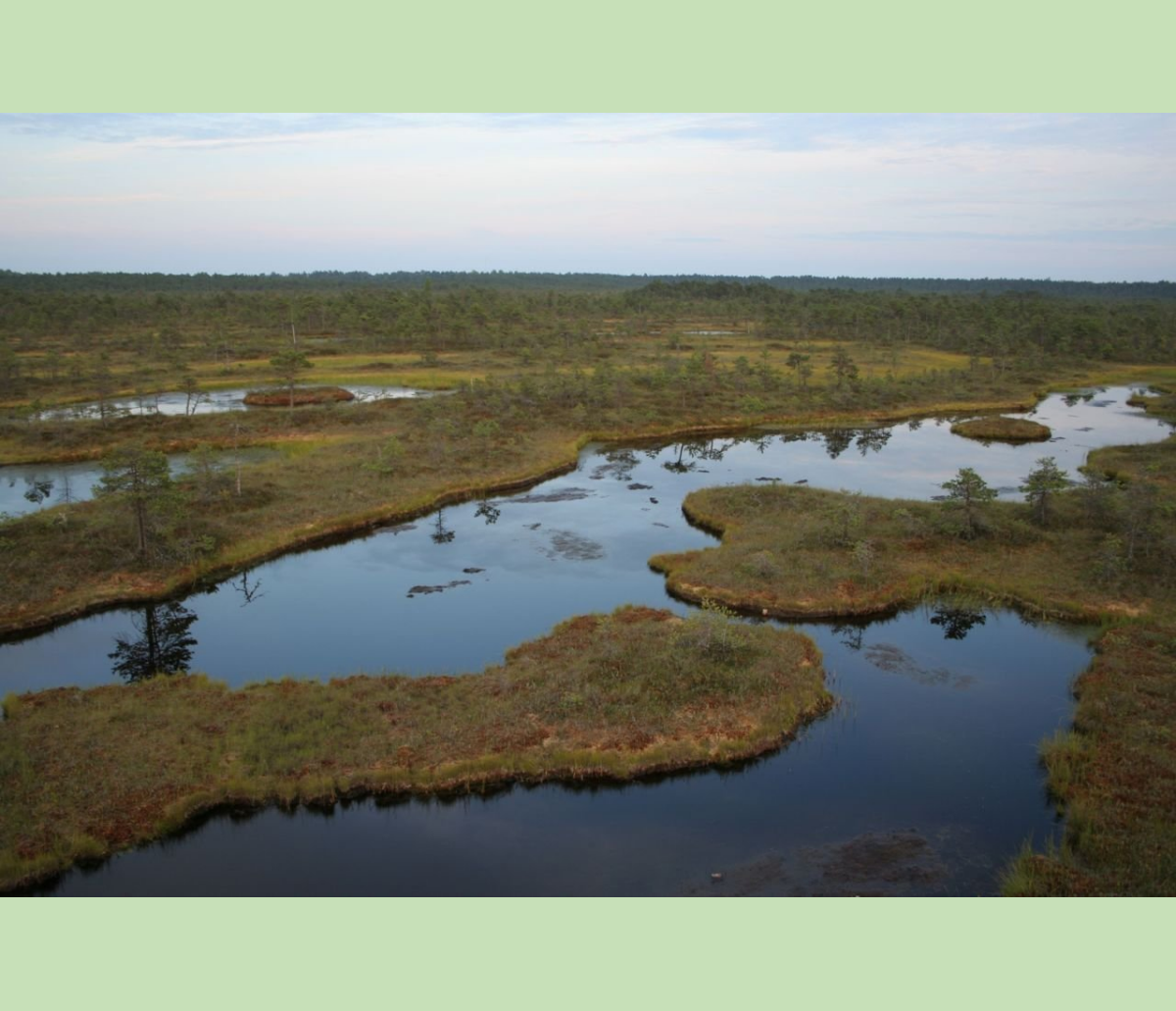
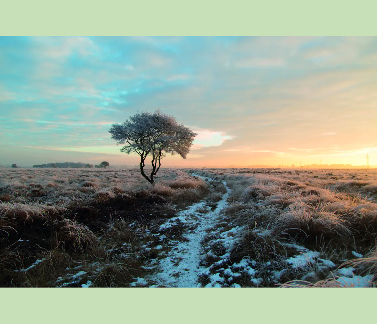
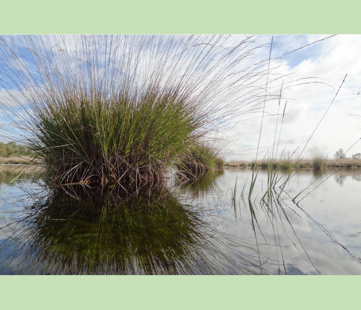
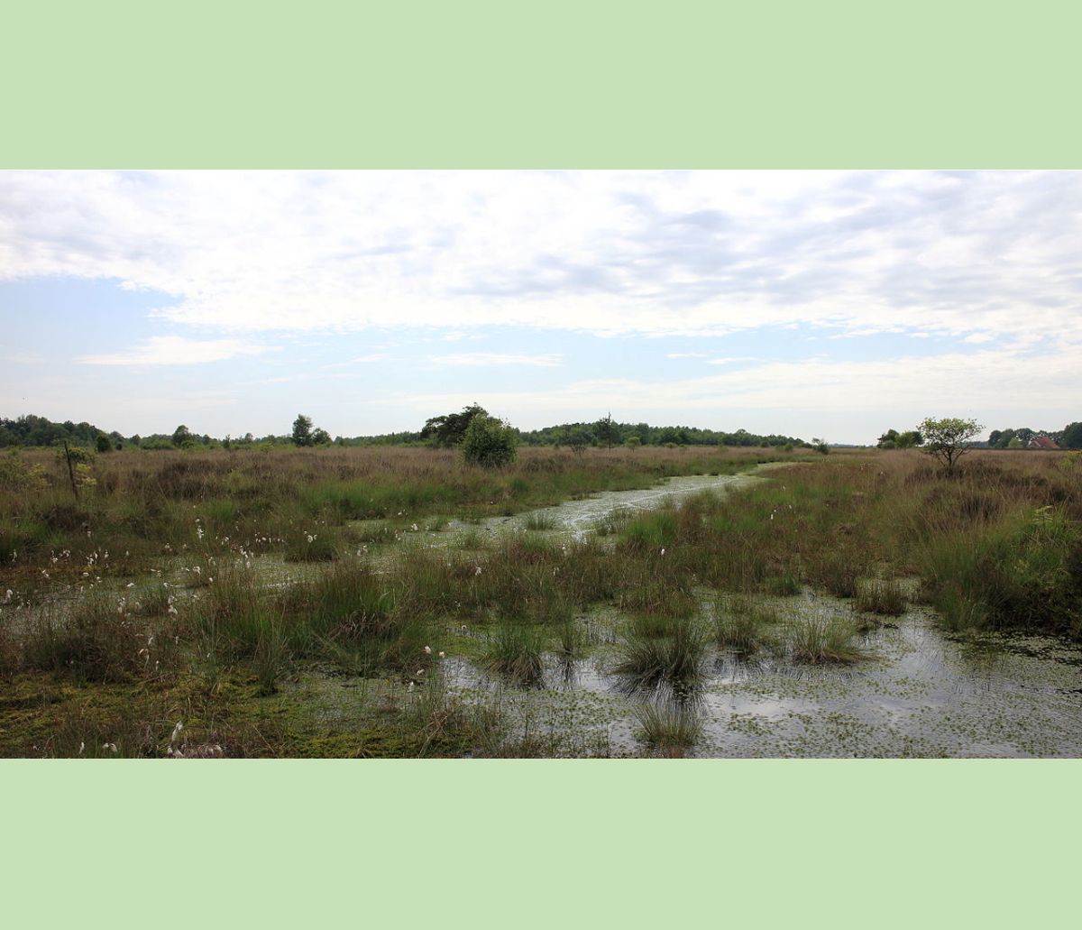
Peatland
Peatland Bargerveen Staatsbosbeheer.
Peatland
Haute Fagnes - Peatland wikipedia.
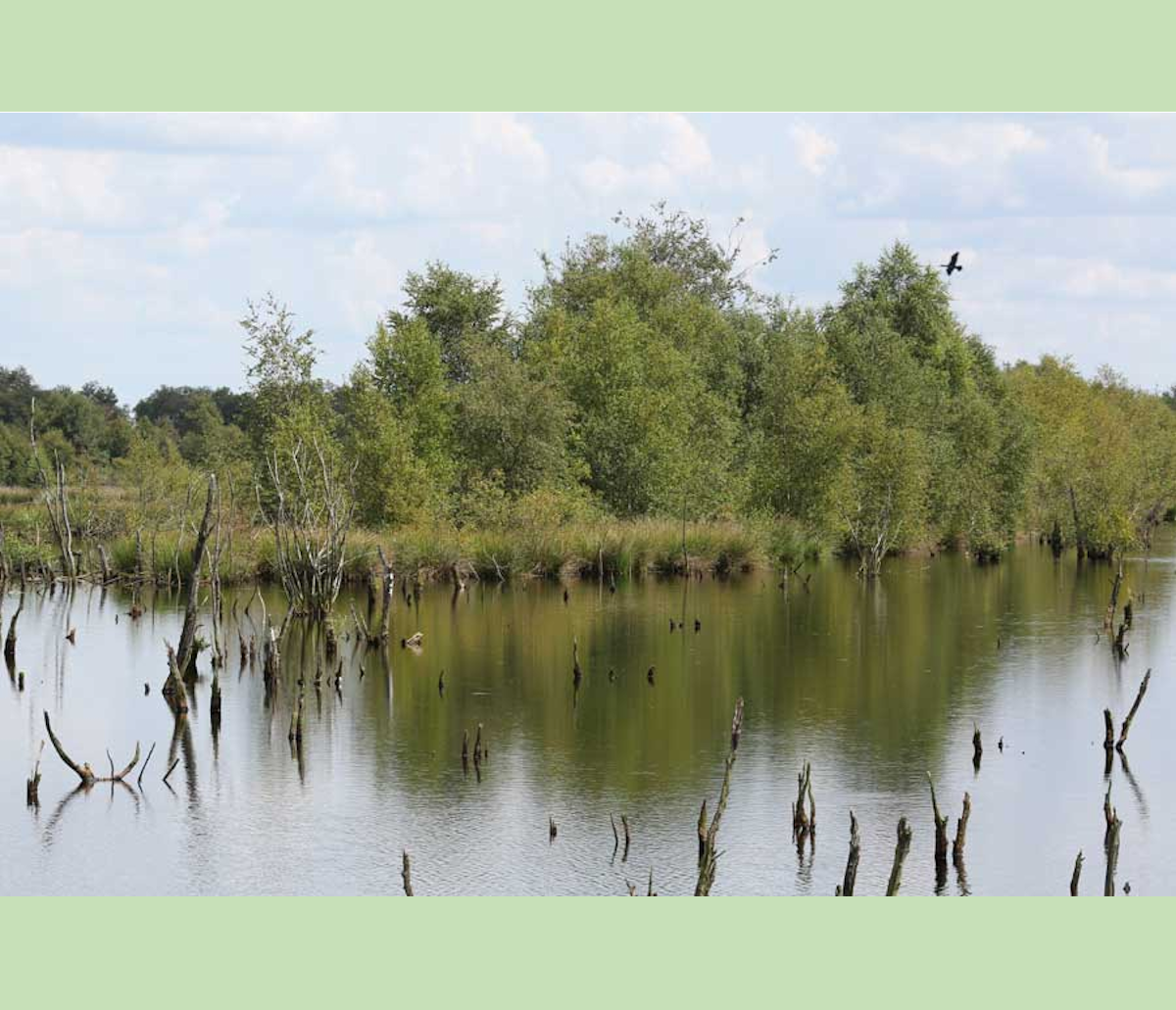
Peatland
Peatland Wierdenseveld.
Peatland
Peatland, Molinia caerulea - Staatsbosbeheer.
Peatland
Peatland, Drents Friese wold - Fochteloerveen (wikipedia).
Peatland
Peatland Bargerveen, wet heather - Staatsbosbeheer.
You have seen that for centuries, between 700BC and up to around 600-800AD, the whole area "West Friesland" was a very unfriendly and very rough and therefor a very sparsely populated area. After around 800 people started to change their surroundings, to improve their living conditions, by reclaiming the peatland.
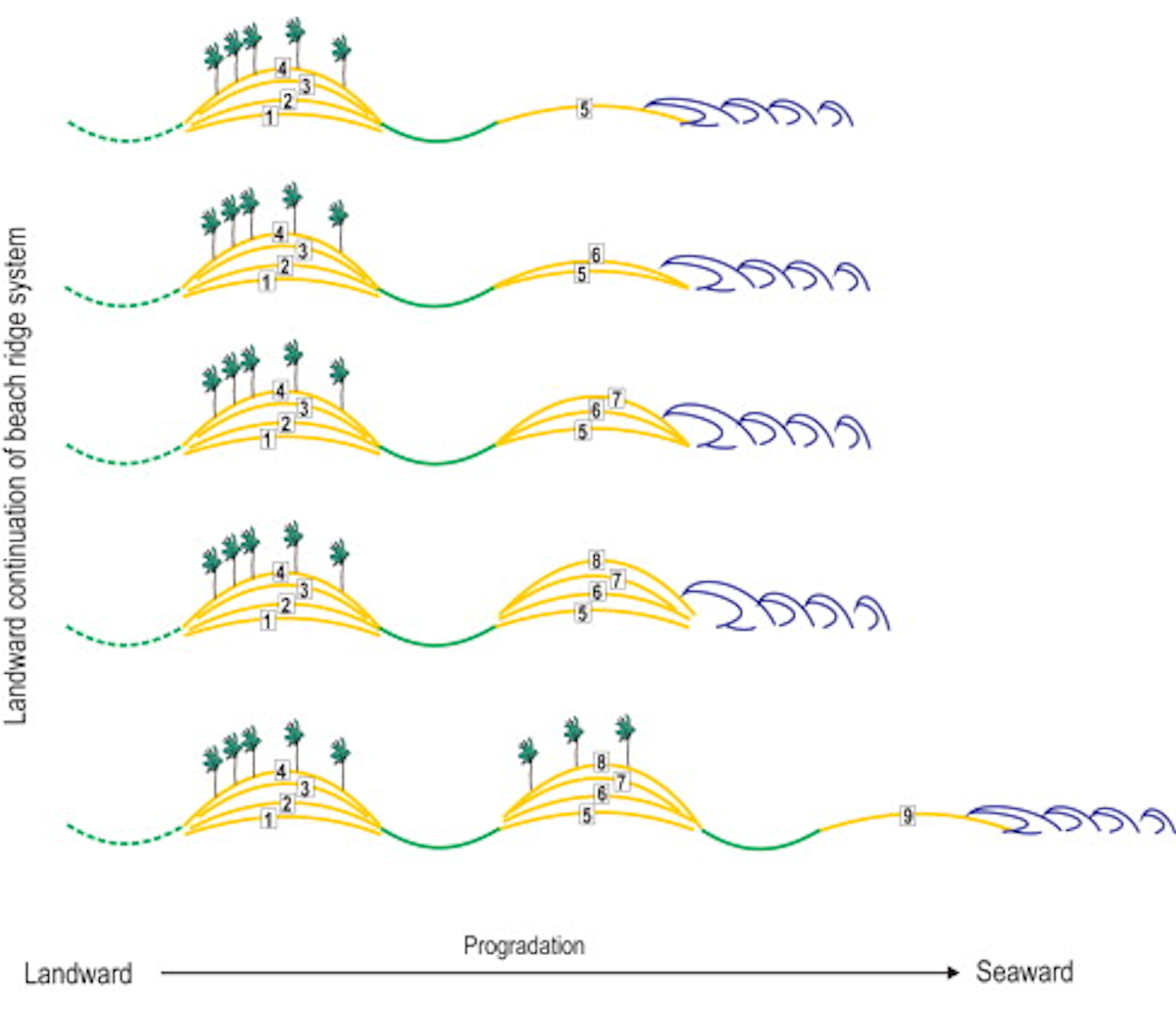
2.4. How was the peatland reclaimed?
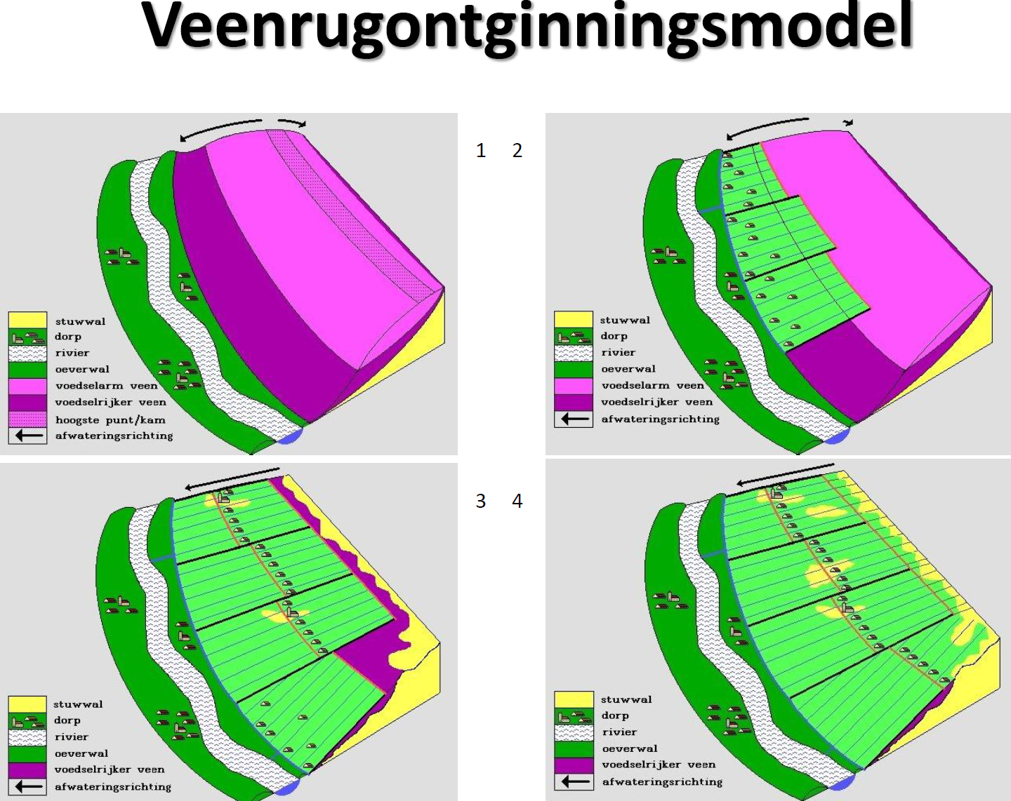
Explanation: Yellow, the sandy moraine. The houses denote habitation. The waves in the grey show the little stream, with in dark green the levee (shore). In lilac the nutrient- poor peat. Dark purple is the more nutrient-rich peat. The black arrows denote the flow of the water. (you can see the peat is like a "blanket" on the yellow sand)
In picture 1 nothing has happened yet. In picture 2 people start digging ditches, perpendicular to the stream and at a distance of about 95-115 meter from each other. So, the lot width was always around 95-115 meter and the length a multiple of 1250 meter. The size is based on a Cope.
A cope is a medieval agreement or contract to be allowed to reclaim an area (parcel or lot) of peatland. This was done by order of the Counts of Holland and the Bishops of Utrecht in the period 950-1300 (and before that). You find that same width and length (1250 meters) everywhere through Holland where peatland was drained. Today the word "Cope" can still be found in city names like Boskoop, Nieuwkoop, Papecop, Heicop etc.
On picture 3 you see people then started to lengthen the ditches into the higher up peatland to get new arable land. The houses moved with them.
Picture 4 shows this could happen more than once, until the end of the higher peatland was reached.
On pictures 3 and 4 you can see that the original sand appeared at some places, after the original peatland sank, providing better places to build houses on. This way little settlements could arise.
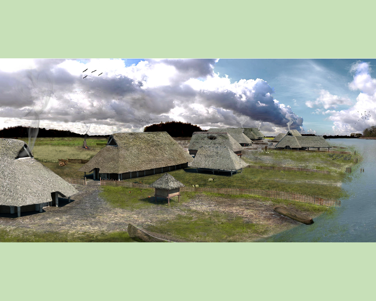
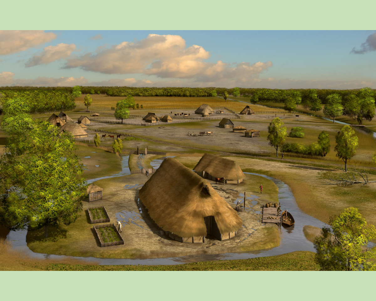
2.5. Villages, trade and other means of subsistence around 800AD.
As described above, people had livestock and simple agriculture as livelihood. Where their settlements were near bigger streams, trade became possible by boats. But not yet in Husidina or Den Helder, it was Medemblik which was mentioned as a trading "city".Why Medemblik?
It was a small village near the water on the trading route to Denmark. That trading route came from a very important city in those days: Dorestad. That was an early medieval trading center with international allure. It was a very important center of trade and wealth. A nice animation of how Dorestad might have looked, is on that page.
It is not quite certain where Dorestad was situated, as it disappeared in later years, some say it was Wijk bij Duurstede, some say Rijswijk. The article "Waar lag Dorestad?" (Where is Dorestad located?) describes (with sources) Dorestad must have been Wijk bij Duurstede.
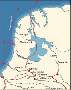
The picture "Trade routes around Medemblik" shows the city of Medemblik being important.
But where are Huisduinen and Den Helder?
They were simply not important enough in those days, not much trade (if any) no harbour (yet), situated in an almost uninhabited area. Their time had still to come!
You can see "Wieringen" on the picture with trade routes around Dorestad, because that was mentioned around the end of the 8th century. It was only after +/- 800AD that the exploitation of West Friesland began, roughly from three sides:
from the higher and drier land on Texel and Wieringen, from the dunes near the westcoast, and in the vicinity of Medemblik.
2.6. Live, houses and "villages" around 800AD.

Between 600 and 700AD the coastal strip was overgrown with woods. The dunes were up to 10 meter above sealevel, and behind the coastal strip there had been centuries of peat growth, causing this area to be high enough from the sea level not to be continually flooded.
Around 700AD people will have started to cut down the huge coastal forests that grew on the beach walls and in the dunes, to serve as wood and bedding. The foliage was used as fodder. Pigs and bee colonies were kept in the clearings in the forest.
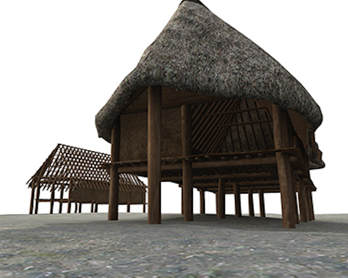
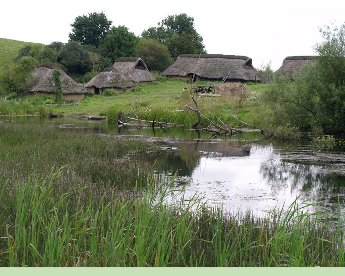
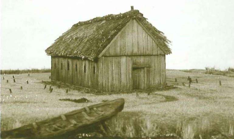
They used the wood to build their houses. Those houses probably had thatched roofs, and consisted of one living space that also included a stable for their cattle. That way it was warm inside in wintertime.
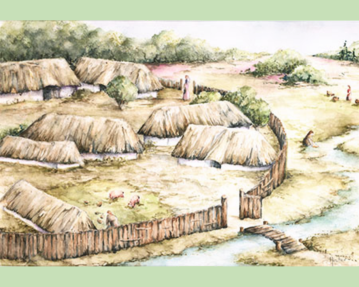
The next pictures are an impression of how things might have looked up to 800AD.
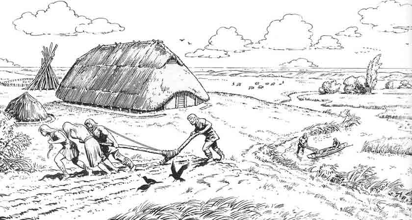
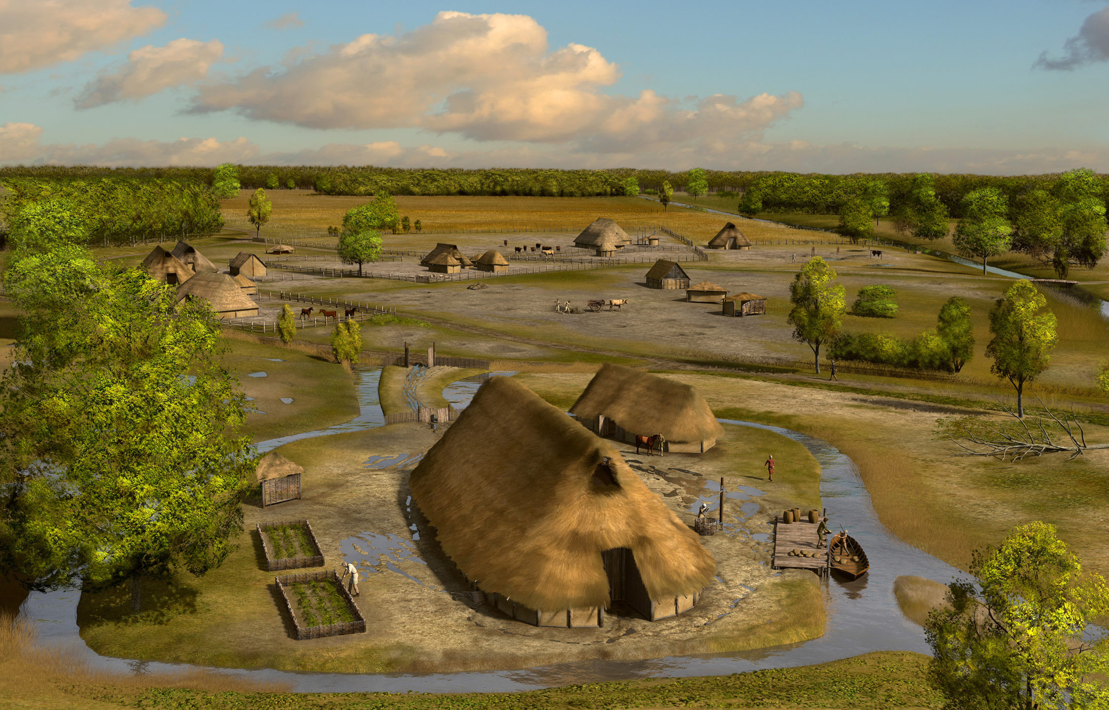
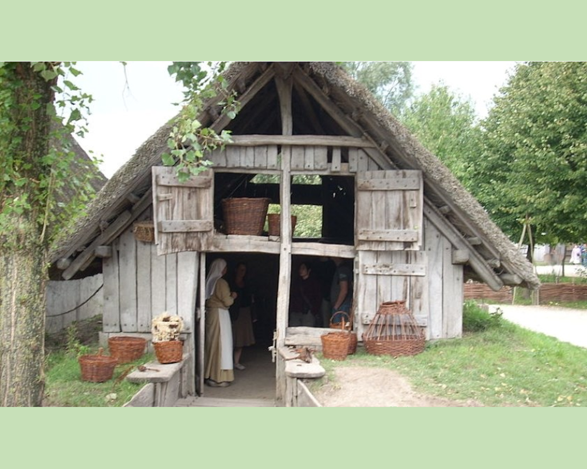
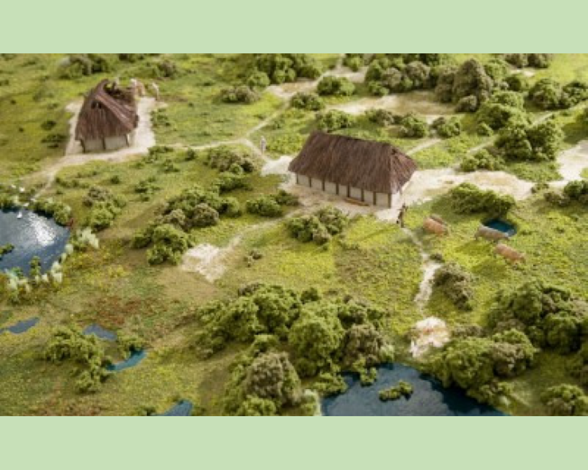
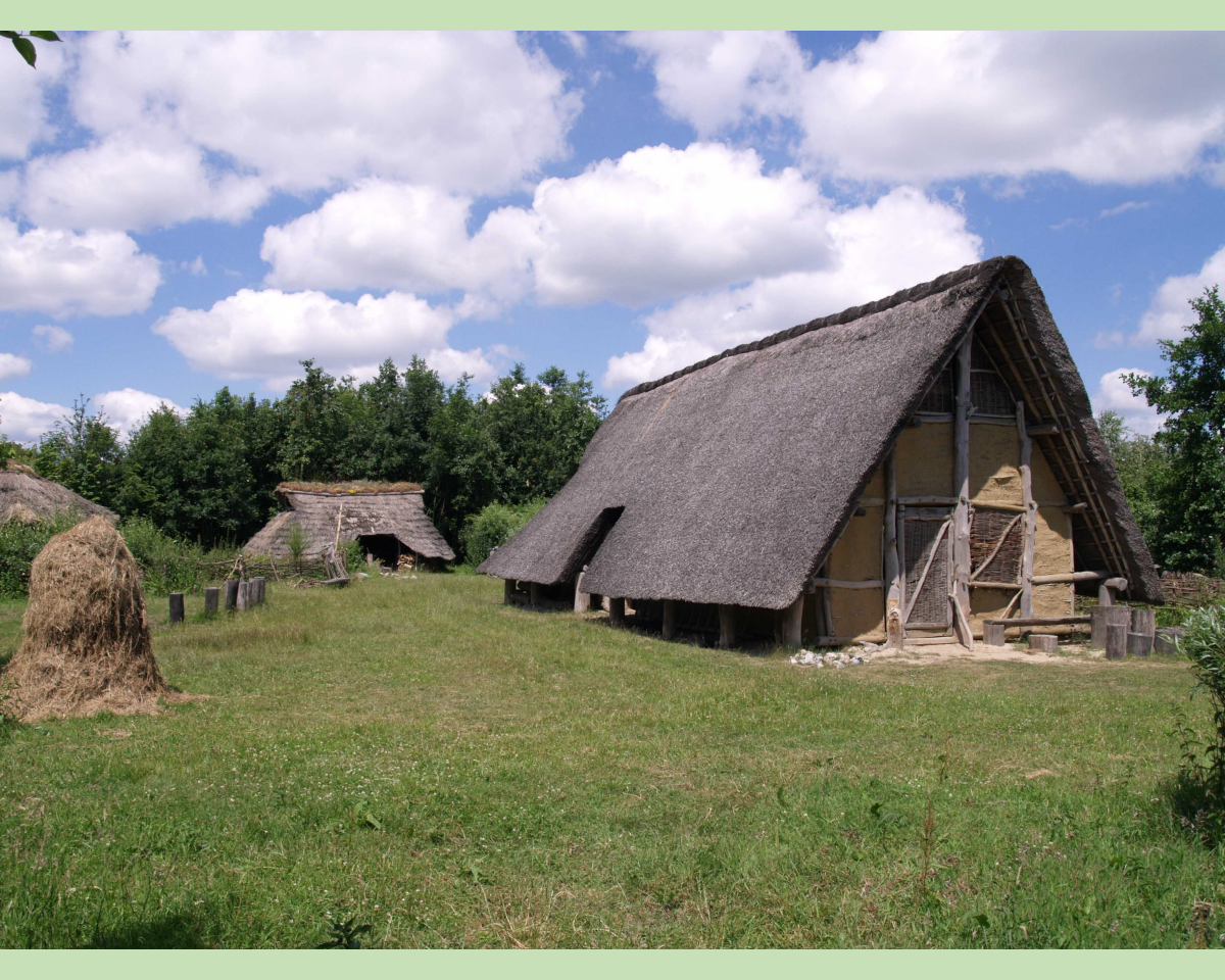
The following pictures try to give an idea of how settlements (small "villages") between 500 and 800AD might have looked. (They are from different areas, so not specifically from Den Helder or Husidina.)
Medieval farm
Medieval farmhouse, picture from Archeon.
Granary on stilts
Granary on stilts 575-775 (near Utrecht).
"Village" around 575-775
"Village" around 575-775 (near Utrecht).
Village in the North Holland dune area
Village in the North Holland dune area.
Iron Age farm
Iron Age farm - brabantserfgoed.nl . This is from earlier time.
Iron Age farm 2
Another example of an Iron Age farm (from an earlier time).
village from the Middle Ages (Odijk)
village from the Middle Ages (Odijk).
Settlement in Angelland around 400AD
Settlement in Angelland around 400AD. Watercolor by Hester Jans-Molenberg
2.7. Historical village names.
But some well-known place names and area names from North Holland, were already known in those days, they were just spelled differently.
Proof of existence of these names, was not found on early maps, but mostly in ancient writings.
Very often the names were found in church records where important persons bequeathed their belongings and their houses and lands to a Church, after their death.
But that could be in churches that were many many miles away from the lands and houses themselves, so as far away as Utrecht!
A few of those names are:
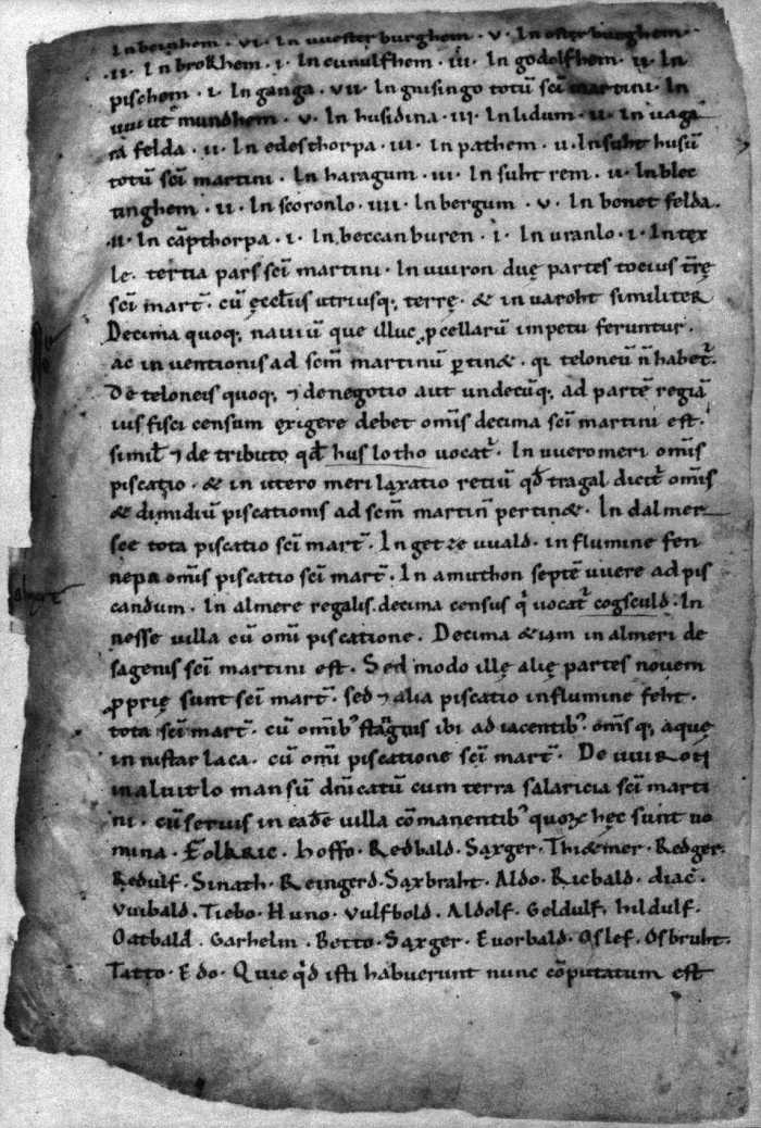
- Husidina - Huisduinen +/-855AD, in the Cartularium Radbodi The list of ecclesiastical property (property belonging to a church) of the "St Maartens" church in Utrecht.
- "fluvius Maresdeop" (around 800AD) - Marsdiep The name was found in a letter of the st Maartens church to king Otto I (936-962 AD)
- "Pethem bi der Zipe" - (Petten (Zijpe)) Around 700-725 a (simple) church in Petten, founded by Karel Martel (689-741), was given to the English monk Willibrord , who bequeathed it at his death in 739 to his abbey of Echternach (in Luxembourg).
- "in pago Wirense" (end of 8th century) A transcript of the goods list of the monastery at Fulda contain the first written records of (Wieringen)
- "Callinge op 't Oghe" (around 920AD) (Callantsoog) Callinge was first mentioned on a certificate of the abbey of Egmond in 920AD. The first village Callinge was situated around 5km more to the west than the current Callantsoog.
- "Camp" or "Campthorpa" (around 918-948) (Camperduin) Campthorpa was first mentioned in the Cartularium Radbodi The list of ecclesiastical property of the "St Maartens" church in Utrecht.
Ok thats all very interesting, but from my history lessons I remember stories about Romans and Vikings and all that. Where are they?
2.8. About Romans, Vikings, Danes and Norwegians.
Now that you have an idea about the landscape and the people and their way of living you could think:
And they lived happily ever after.
But that is not true.The Roman empire ruled until about the 4th century, but little is known about what happened during that time in our environment. But for the Vikings it is quite a different story. From the list of ecclesiastical property of the "St Maartens" church in Utrecht, we already knew about the habitation of Husidina (Huisduinen), Maresdeop (Marsdiep), pago Wirense (Wieringen) en Texla (Texel) around 850-900.
All in areas around Den Helder, Texel and Wieringen.
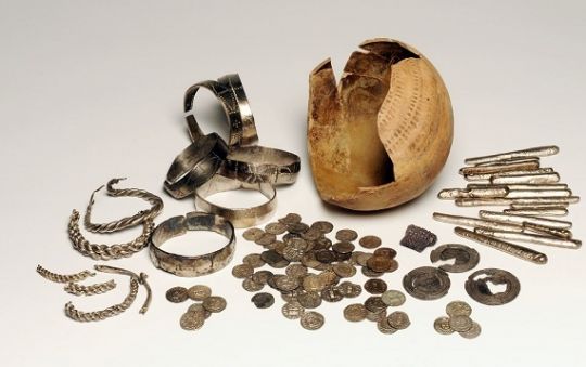
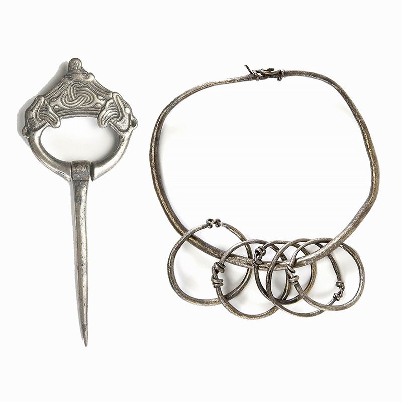
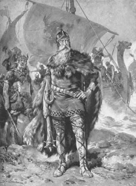
Very intriguing was the discovery of a silver Viking bracelet, and many more Viking treasures around Wieringen. The Vikings called Wieringen "Wiron". A Danish Viking named Rorik (who lived on Wieringen for about thirty years) ruled over Wieringen and "West Friesland" (841-873), so perhaps those treasures belong to him.

Frankisch monarchs could not do much about the raids of the Vikings, so they tried to make them swear allegiance to them, in exchange for allowing them big areas of land to rule. The Danish Rorik was one of those feudal men. He tried to prevent the raids and looting of his fellow countrymen in exchange for ruling over West Friesland.
The fact that such a Danish king lived close by for many years, could mean that the area around Wieringen has suffered from attacks and looting for many years.
Red arrows: todays borders (which are black lines).
Green arrows: the coast of todays island of Texel.
Blue arrow: current (2020AD) coastline next to Huisduinen. As you can see the position of Husidina, was around 5 km to the west of the current coastline. So Husidina must have "moved" to the east. And it did.
But how did that happen?
Go to the next chapter to find out how.