
Where to find Den Helder.
I live in the Netherlands, near the city of Den Helder. This city is situated at 52º 57' NL and 4º 45' EL. For those of you who live far away, you can find Den Helder in the Netherlands in Europe, as you see on the map. The big red mark in the center denotes the city of Den Helder in the province "Noord-Holland".
When you zoom right in, you can see Den Helder is surrounded by water on almost three sides. To the left is the North Sea, between Den Helder and the island Texel we find the estuary called "Marsdiep", and to the right the "Wadden zee" (Shallows Sea)
"Marsdiep" comes from "Mare" which means "Lake", and "Deop" which means "stream". Around the year 900, it was named after the stream that ended in the top of the province as we know it now. That stream is long gone, but its name still excists for the estuary. You can read more about that on the history pages.
The yellow "Island" to the left, between Den Helder and Texel, is just a big sandbank called "Noorderhaaks", or also called "Razende Bol" (translated as "Raging Globe") and it is only inhabited by seals and seagulls. It is around 4 square kilometers. Because of the strong tides it "moves" to the right (eastward) about 100 meters a year. (YES 100 meters!!!) A big part of the "Razende Bol" is marked as closed area so the seals can raise their pups in peace.
Province Noord-Holland and "Afsluitdijk".
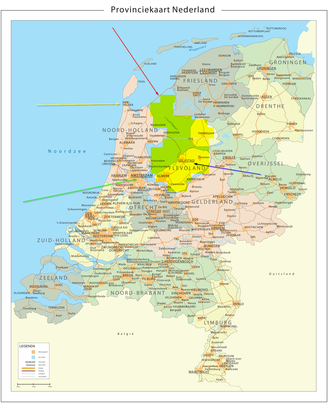
When you examine the map more closely, you will notice a thin orange line in the water (marked with a red arrow), about 1 inch to he right of Den Helder. That's the "Afsluitdijk" (Closure-dike), a dike build in the beginning of the last century. Below that dike you see a greenish marked area, that once was the "South Sea", (Zuiderzee) a sea separating the two parts of our country. We needed the "Afsluitdijk" to calm down the water in that sea, and to better protect the land from flooding.
The "Afsluitdijk" was built under the leadership of engineer Cornelis Lely, and work started in 1927. The last opening in that closure-dike was dammed on May 28, 1932 and it has a monument with information about the whole process. The "Afsluitdijk" is 90 meters wide and 30 kilometers long and connects our province "Noord-Holland" with the province of "Friesland". At first there was only a small road on top of it, and a railroad was planned there too. The railroad was never built and its space was used to create a big motorway instead, together with a cycle path. When the dike was built, it separated the Shallows Sea from the "South Sea" (Zuiderzee) as it was called in those days. The South Sea turned into a fresh water lake because of the small river "IJssel", pouring its water into it, and it is now called "IJsselmeer" (IJssel-lake).
We even made a whole new province in that lake, reclaiming new land out of the sea. Try to find "Lelystad" (Lely-town) on the map, its the capital of that province and it is named after engineer Lely. The whole yellow area, surrounded by the thin line, where you found "Lelystad", used to be sea.